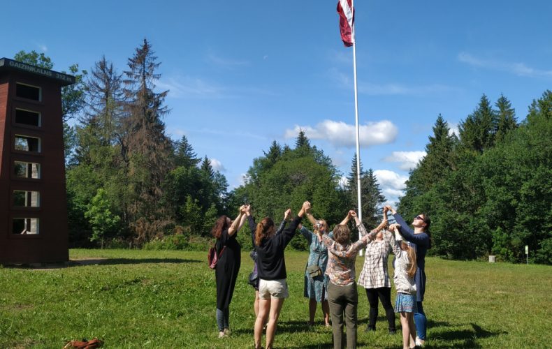
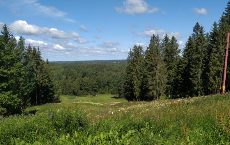
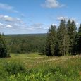
Gaiziņkalns is the highest mountain in Latvia. The absolute height of the mountain is 311.94 m a.s.l., the relative height – 61.6 m, it stretches about 1 km long and 650 m wide.
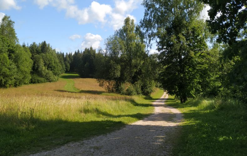
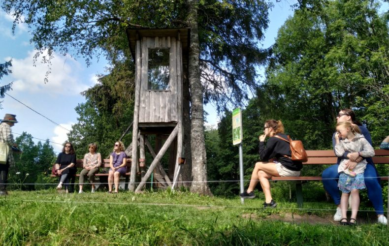
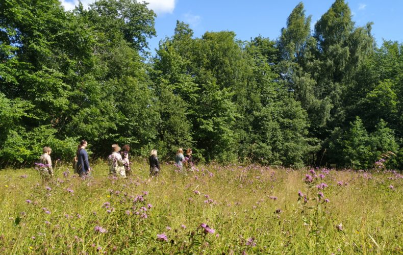
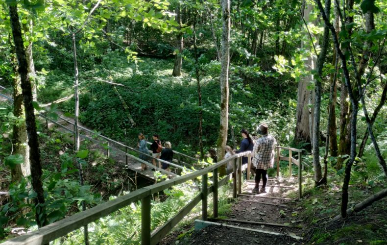
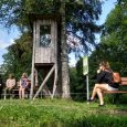
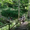
Naturetrail “Gaiziņkalns trail”, length 2 km. It is circular and leads over the top of the hill and the road at the foot of the hill. The trail is marked, there are stairs on the north side (hidden behind a café), a large gazebo at the top of the hill and information boards along the trail.
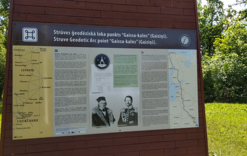
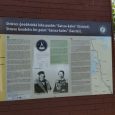
At the top of the hill there is the Struve geodetic circle point “Gaissa-mountain”. This is 1 of the 16 “Struve Geodetic Arc” points in Latvia. The point was called Gaisakalns Point and was surveyed in 1824 under the leadership of the famous Friedrich Georg Wilhelm Struve. The total length of the geodetic circle is 2822 km. The arc crosses 10 countries from Norway to Ukraine. The Strūve Geodetic Arc is a UNESCO World Heritage Site.
Guided tour of the Gaiziņkalns trail. Danuta Kiopa, tel. 29453973 and Sarmīte Rukmane, tel. 20097882.
Programme for school groups “Explore Gaiziņkalns”:
* Led by environmental guide Danuta Kiopa, tel. 29453973.
* Time – 90 minutes. Activities: climbing Gaiziņkalns, walking along the nature trail (2 km), worksheets with educational elements, environmental education activities (identifying and measuring trees, studying animal creatures, etc.).
* Price: up to 20 pers. – 30 EUR per group; over 20 pers. –
Hiking, cycling:
*8 km on foot or by bike “Gaiziņkalns-Abrienas hill-Viešūra jezero-Gaiziņkalns”. Route description + map HERE.
* 22 km by bike “Gaiziņš hills”. Route description + map HERE.
* 9 or 15 km on foot or by bike “Kala Lake and Blueberries”. Route description + map HERE.
Places to visit in the vicinity of Gaiziņkalns:
* Boleni spring.
* Holiday house “Piekūni”, hiking trails, sauna knowledge, bathhouse, astrology, accommodation, sauna.
* Artists’ workshop “Stone House Gallery”.
This and that about Gaiziņkalns:
* The name Gaiziņ comes from the word Gaiszinis, as the mountain is still considered to be a reliable weather forecaster. If it is shrouded in fog or has a misty haze rising from it, precipitation is expected no later than the third day.
* The Gaiziņkalns Nature Park (2026 ha, established in 1957) extends around Gaiziņkalns. The area was created to protect the characteristic hilly terrain and lakes of the Vidzeme Highlands landscape, their natural and cultural values. It is defined as an outstanding scenic area with the characteristic landscape of the Vidzeme Highlands. The nature park is included in the European Union’s Natura 2000 network of protected areas.
* Gaiziņkalns is privately owned. The southern half of the hill belongs to the owners of “Lejas Gaiziņu”, while the majority of the hill and the northern half belong to the owner of “Kalna Gaiziņu”. None of the landowners live in the vicinity of Gaiziņkalns.
The hill is open to the public.
* The Gaiziņkalns trail is managed by the Madona Municipality.
At the northern foot of the hill is the recreation base “Gaiziņš”.