The Daugava Valley Nature Park (area 1066 ha) was established to protect the most characteristic section of the Daugava Valley with all the terraces created by the river, which remained unchanged during the construction of the Pļaviņas hydroelectric power plant.
Routes:
1. Daugava Trail. 10km
The Daugava Trail reveals the varied landscapes of the Daugava Valley: forests and meadows, river rapids, springs and large boulders, geological formations – a dolomite outcrop and a valley escarpment.
The steep slope of the valley offers broad-leaved forests interspersed with dry to moderately wet steppe meadows.
 The entire length of the trail offers spectacular cultural landscapes.
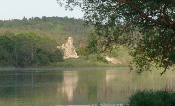
The most beautiful panorama is from the Aizkraukle hillfort, which has been inhabited since the 1st millennium BC. The wooden castle built here was burnt down by the Crusaders in 1205.
Between the Daugava River and the mound’s elevation is the site of the Aizkraukle Old Town, where you can see the ruins of the 13th-17th century Aizkraukle stone church.
On the Riga – Daugavpils highway is the 1694.
Going further, at the mouth of the Karikste River, you can see the ruins of the Livonian Order castle built in 1224. A little further on is the old cemetery of Aizkraukle.
At the end of the trail are the ruins of a former lime kiln, with unusual dolomite outcrops and many streams nearby.
The well-equipped recreation areas “Priediņas” and “Saķis” await the traveller, while excellent swimming areas and a beach volleyball court are located at Lasmani quarry.
The trail is suitable for both walkers and cyclists.
2. Senbaznīcas Trail
 The trail leads along the Aizkraukle Castle Mound to the 13th – 17th century. The site of the Aizkraukle stone church, which once stood by the Aizkraukle Old Town, on the banks of the Daugava.
The trail is suitable for hikers.
GPS coordinates at www.balticmaps.eu
Lat: 56.6215912, Lon: 25.1304476
3. Ašķere or Spīdalas Trail
The 400m long trail winds along the Ašķere river gorge, in the depression of which the Ašķere river flows with a very rocky bed and banks. The Ašķere gorge was formed 15 thousand years ago when the great glacier crossed the territory of Latvia.
 In the 7th – 11th centuries, there was an ancient Scandinavian port at the mouth of the Ašķere River in the Daugava River.
In the territory of the trail there is a micro-reserve of the great or giant salamander (Glis-glis) . The colony of the greyish, 15 – 20cm (excluding tail) long rodents has been one of the most stable habitats in Latvia for 20 years. The animal is mostly active at dusk and at night.
In honour of the heroine of Pumpurs’ epic “Lāčplēsis”, the daughter of Aizkrauklis, Spīdala, the trail is also called the Spīdala Trail.
A large oak block with a hollow in the middle was once found in Ašķere ravine, where a person could easily crawl in. The block is now in the Lielvārde Museum.
The trail is suitable for pedestrians on foot.
4. Anton’s Trail
When leaving the site of St. Basilica on the Riga – Daugavpils highway, it is recommended to follow the Anton’s Trail leading up to the Skrīveri Institute of Agriculture. The trail winds along a small stream, here you can see a variety of flora, picturesque boulders in the stream.
The trail is named after Leon Antons (1933-2000?), a teacher at the Skrīveri A. Upītis Secondary School. The teacher was once the initiator of the creation of tourist trails in Skrīveri. Under his leadership, more than 15 trails were created, including the Spīdalas Trail.
The trail is suitable for pedestrians on foot.
 5. Karikste Trail
One of the most interesting places in the Daugava Valley Nature Park is the Karikste River. The river is 10km long, it is riffled, with a big drop, in places it flows through a 5-10m deep gorge. The Karikste River starts in the Tunķu Swamp near the Aizkraukle railway station. From Aizkraukle railway station to Vecaizkraukle the river bed is regulated, later up to the mouth of the Daugava it flows through a distinct valley.
For pedestrians, the best way to get to know the Karikste is to take a 300m long walk from the former Shiron mill to the mouth of the Daugava. Here there is a half-collapsed mill dam, where a two-tiered waterfall about 2.5 m high has formed.
Further on you can see the ruins of the Livonian Order’s stone castle. It is located at the mouth of the Karikste Daugava, where a harbour once stood.
The trail is suitable for hikers.