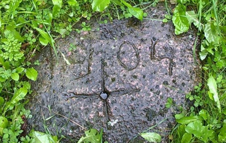
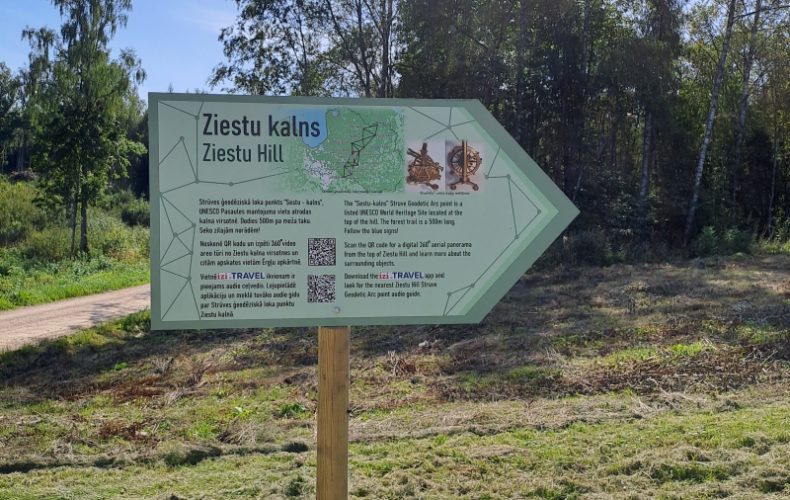
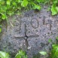

Located in Sausnējas parish, at the top of Ziestu Hill – 216.5 m above sea level.
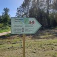
At the foot of the hill there is a parking lot and a resting place (GPS 56.842236, 25.644318). The route is marked with blue signs.
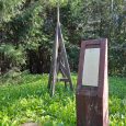
In Sausnė, in the museum “Līdumi”, there is a mint and an interactive stand for the commemorative coin “Sestukalns”.
Strūves Geodetic Arc (SĢL)
A unique 19th-century museum with a unique view of Strūves. Geodetic surveying system for determining the size and shape of the earth. It was carried out between 1816 and 1855 by Friedrich Georg Wilhelm Struve, professor of astronomy, and Colonel Karl Friedrich Tenner, military topographer.
The Arc of Stroud extends approximately along the 26° meridian from Hammerfest on the Arctic Ocean in Norway to the town of Ismail near the mouth of the Danube on the Black Sea, crossing the territory of 10 countries in total: Norway, Sweden, Finland, Russia, Estonia, Latvia, Lithuania, Belarus, Ukraine and Moldova. The total length of the Arc is 2,822 km. The measured meridian arc includes 25º 20´ of the circumference of the globe.
The geodetic arc of Struve is formed by 258 triangulating triangles. 265 main points, 60 subsidiary points and 13 coordinates were established. The distance between the points is between 30 and 40 km. The arc surveys started from the Tartu (Tērbata) Observatory. The relative accuracy of the measurements was very high – only 4 mm error per kilometre.
Scientific objective of the GGS: to refine the flattening of the Earth polewards according to Newton’s theory. Practical objective: to measure and obtain data for the mapping of Tsarist Russia and the Kingdom of Sweden. Political objective: triangulation was a 19th century phenomenon. ”
The observations of the geodetic arc of Struve were led by two outstanding personalities of their time:
Friedrich Georg Wilhelm Struve (1793 – 1864) was a German astronomer, professor at the University of Tērbata, director of the Tērbata and Pulkovo observatories. In 1931 he was appointed an advisor to the Russian Empire and a member of the nobility, from which time his surname was “von Struve”.
Karl Friedrich Tenner (1783 – 1859) was a military geodesist of German origin. From 1809 to 1811 he participated in the creation of the first triangulation networks in the Russian Empire, and from 1816 to 1822 he was assigned to triangulate the provinces of Vilna, Courland, Grodno and Minsk. In 1832 he was appointed an honorary member of the St Petersburg Academy of Sciences.
Latvia was the only country on whose territory both Struve and Tenner carried out surveys. Struve established 11 points in the northern part of Latvia from Oppekaln to Jacobstadt. Tenner surveyed 5 points in the southern part of Latvia from Pilkaln to Bristen. Two of the 16 points in Latvia are linked geodetic-astronomical points, Jacobstadt and Bristen, where observations were made and coordinates were determined. The measurements made were among the first trigonometric measurements in the territory of Latvia and were the basis for the map of Vidzeme.
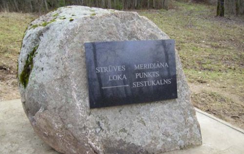
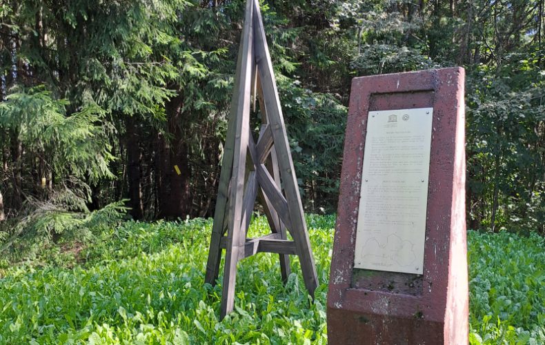
In 2005, the Struve geodetic arc was inscribed on the UNESCO World Heritage List as a unique geodetic survey system, the longest and most accurate of its time, and an outstanding testimony to the scientific, historical and technical development of its time. The UNESCO World Heritage List includes a total of 34 points of the Struve Geodetic Arc. Of the Struve geodetic arc points in Latvia, the UNESCO World Heritage List includes points in Jēkabpils and Ziestukalns.
In Latvia, the Council for the Conservation and Development of the Struve Geodetic Arc has been established, consisting of representatives of the Latvian Geospatial Information Agency, the Latvian National Commission for UNESCO, the National Cultural Heritage Board and the municipalities in whose territories the GSC points are located.
Madona municipality has 3 Struve Geodetic Arc points – Sestu-hill, Gaissa-hill and Nessaule-hill.
Photo from the Madona TIC archive.